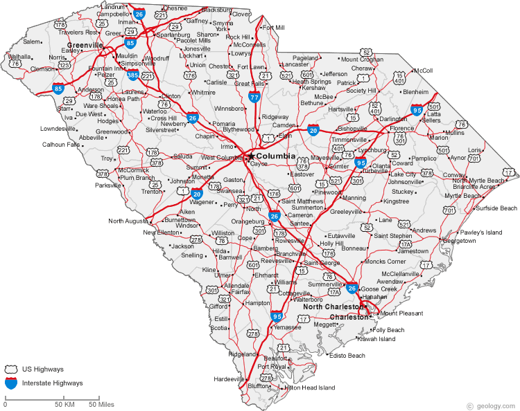
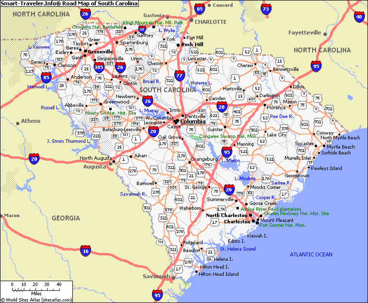
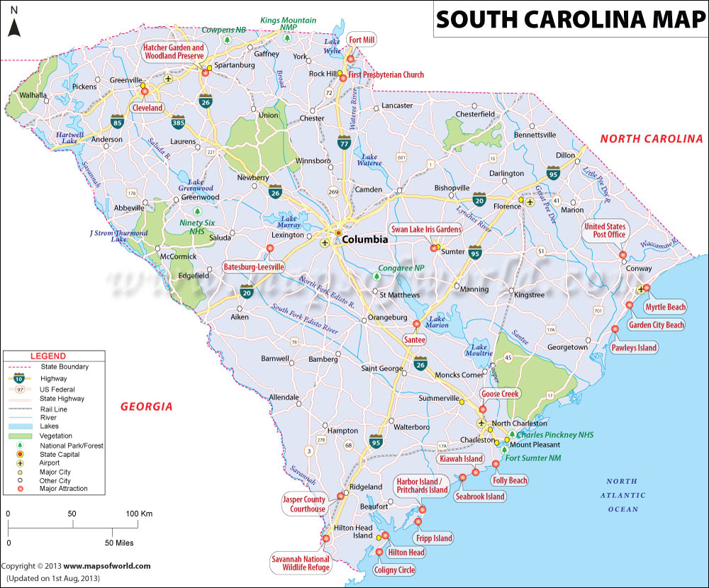
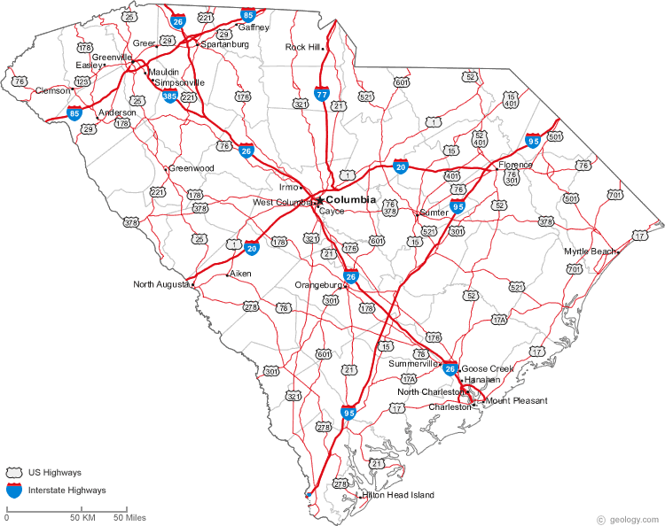
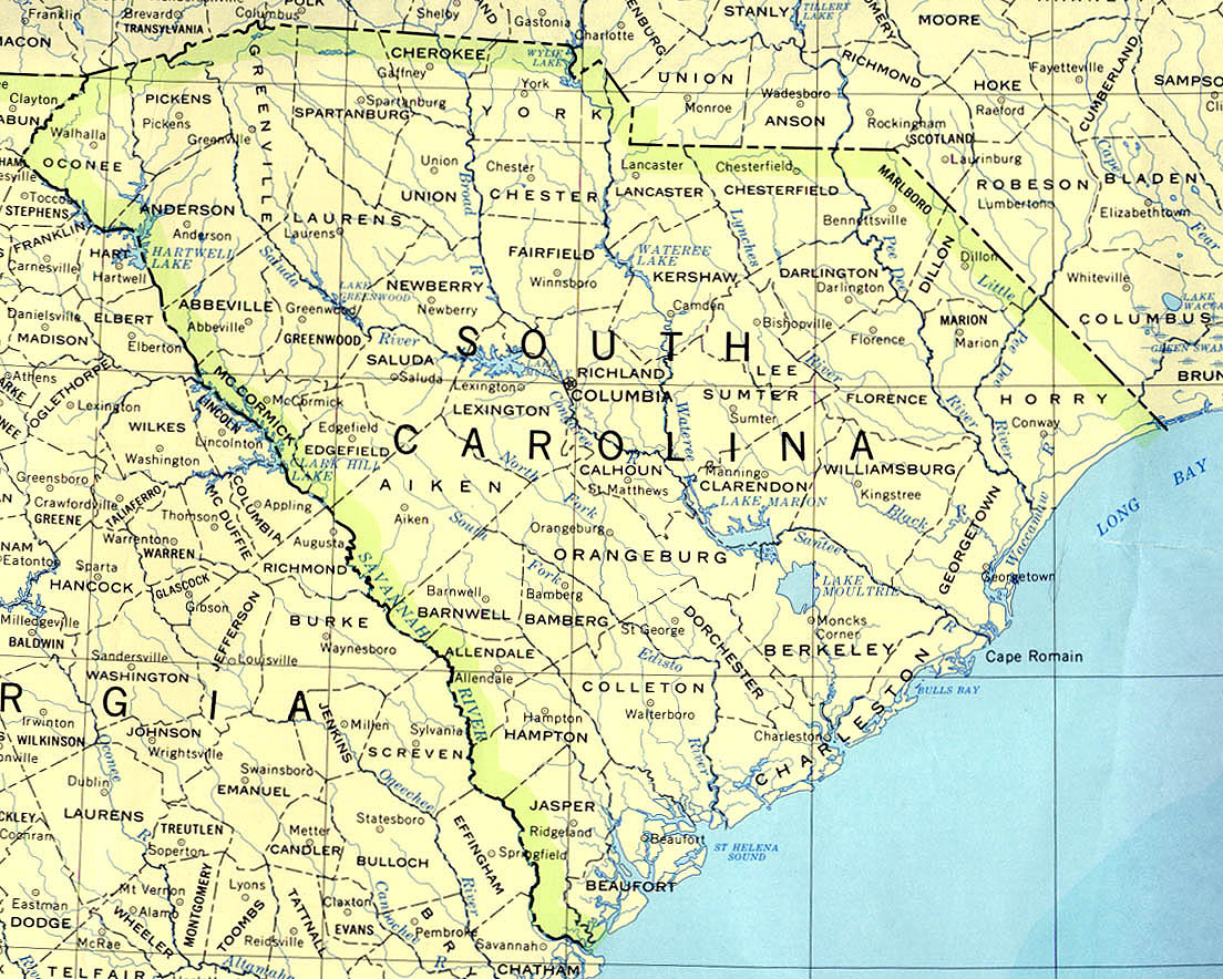
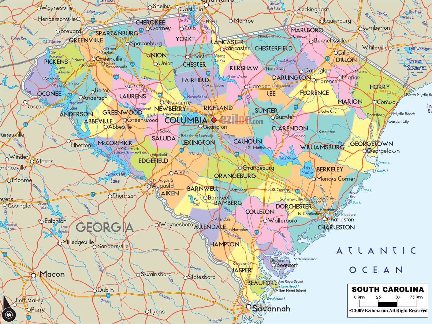
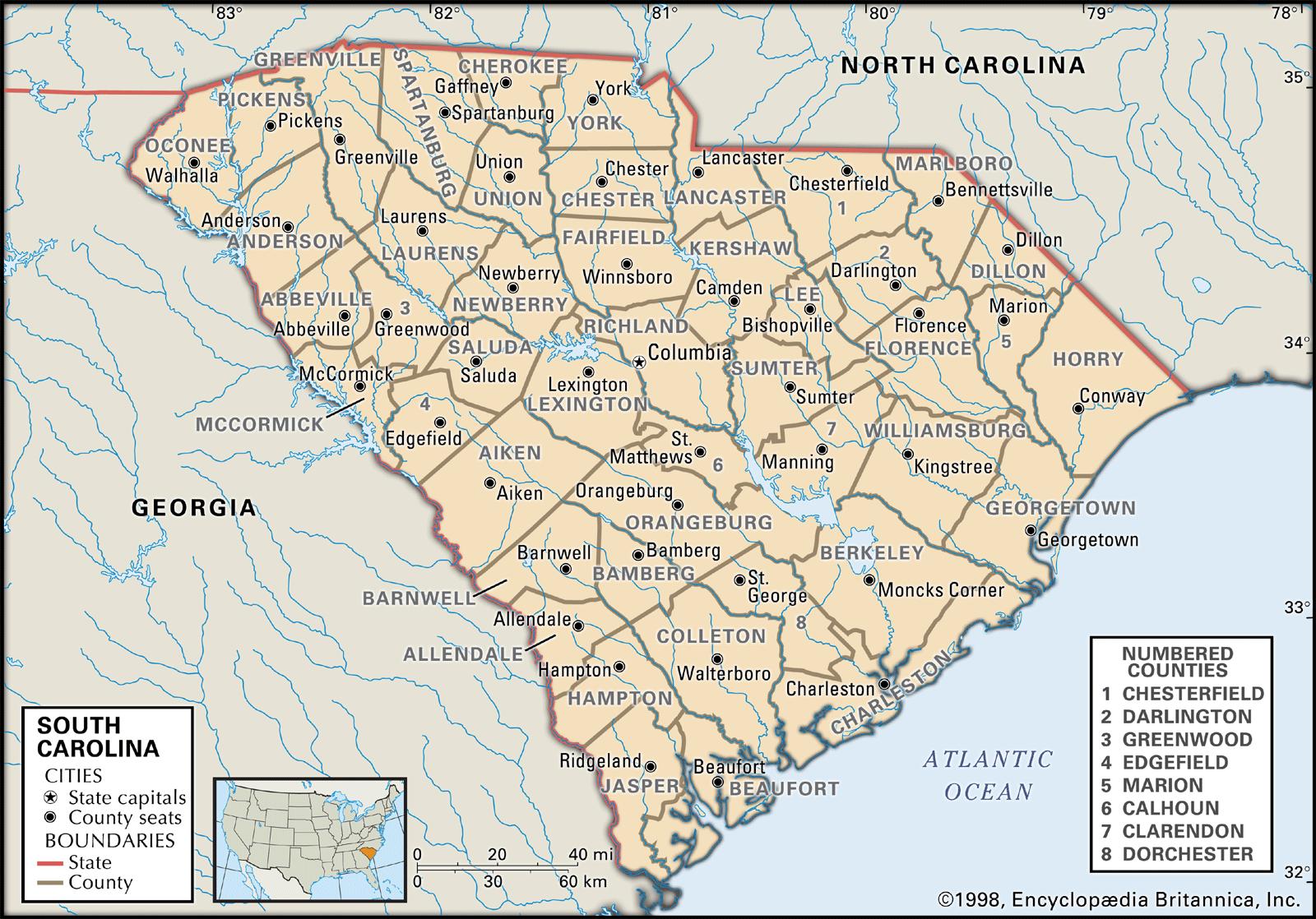
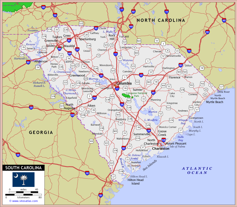
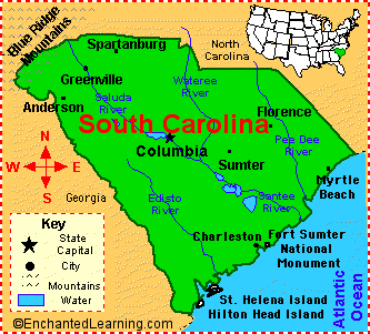
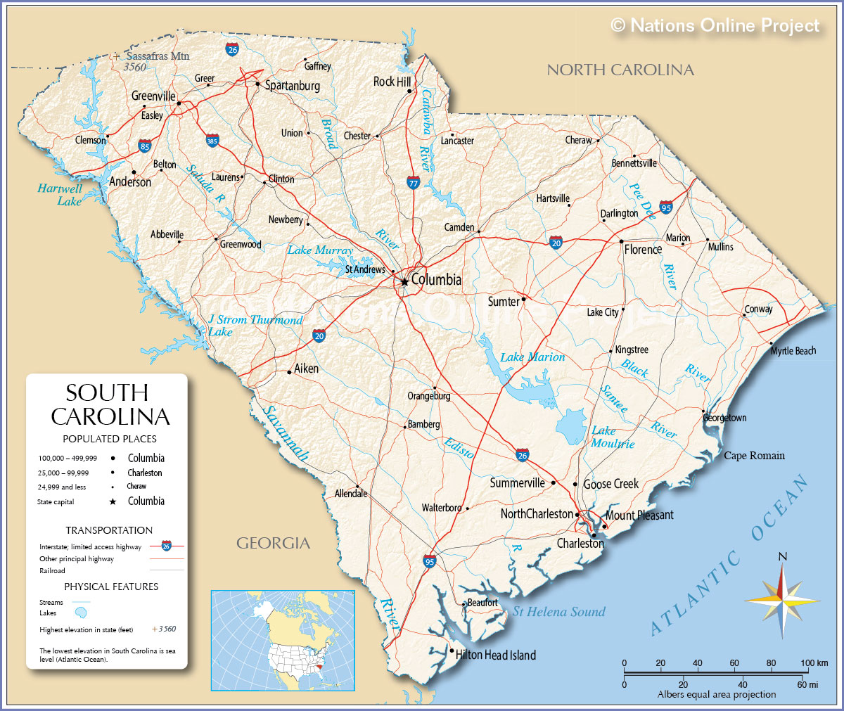
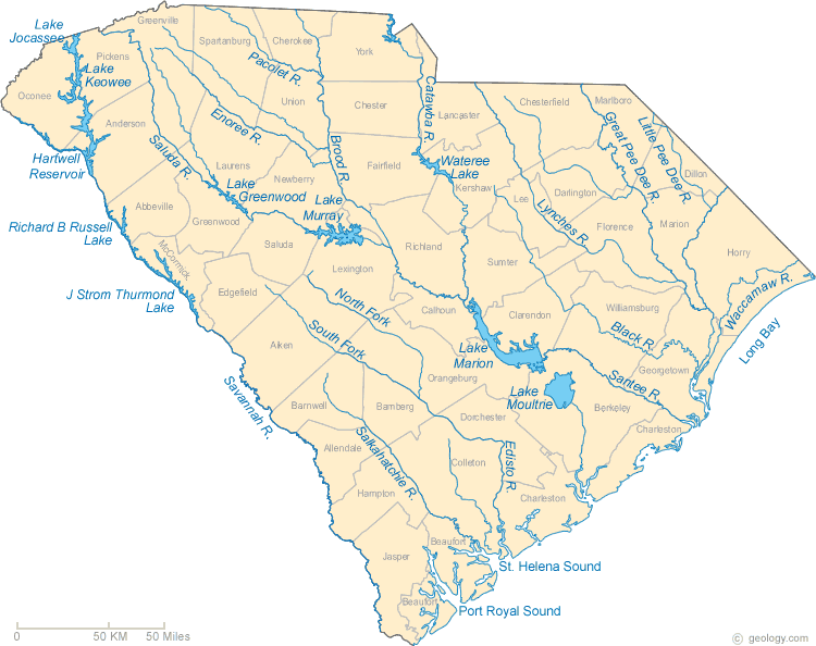
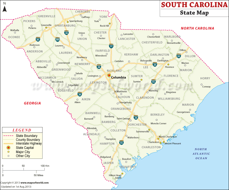
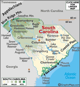
South Carolina, is one of the 50 states of the United States of America. South Carolina is located in the southeast of the country. South Carolina declared independence from the United Kingdom that was one of the thirteen colonies in 1776. In the American Civil War between the southern states became the first state to leave the United States. South Carolina ranks in the lower tier compared to other states in terms of national income. Among the most important income sources, tobacco, livestock, textiles, chemicals, machinery industry, and tourism. If you have a plan to visit there, you should have a South Carolina map to see the local details and facilities.


